


The Upper Fort in its Environment: Resources and Natural Systems
By Robert Coutts
For the better part of a century Upper Fort Garry was an integral part of the economic and political culture of the west. It was, as well, the heart of a settlement that was in many ways a product of its physical environment – its geography and climate.
Located near the forks of the Red and Assiniboine, Upper Fort Garry was situated on a treeless plain. Historically, the riverbanks were fairly heavily wooded but by the time of the fort’s construction in the 1830s the settlement was largely denuded of trees, cut down for building purposes and for firewood. By the 1840s settlers and company servants were travelling far afield for wood. Winter cutting expeditions went as far north as Bird’s Hill and Lake Winnipeg for a season’s supply of firewood and later for the wood to power the steamboats that plied both rivers.
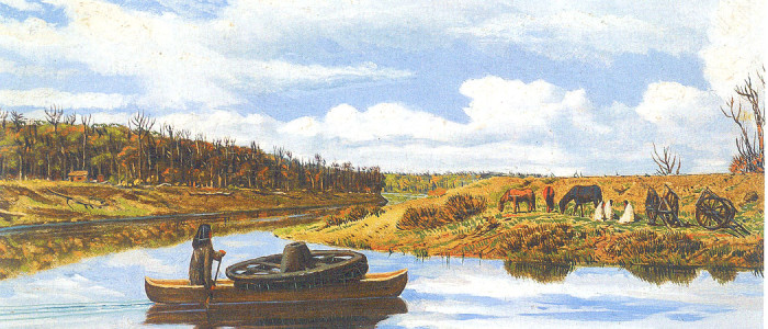
The rivers were the lifeblood of the community. They not only provided for ease of travel throughout the settlement (the few roads being rough-hewn and virtually impassable for periods of the year) but were sources of water and fish. Their periodic flooding significantly affected the settlement and fort operations. A disastrous flood in 1826 — still the largest on record in the Red River area — destroyed the log-palisaded Fort Garry and led to the building of the limestone upper fort farther back from the river and on a small rise of land. But perhaps most importantly, the junction of the Red and Assiniboine was the geographical centre that defined the colony as a riverine settlement, the long narrow river lots forming the land use characteristic of the region.
From the early 19th century river lots were the canvas for a unique form of agriculture. The upper fort was the supply centre, later becoming the gateway to the rich agricultural lands to the west.
Centuries before the settlers arrived Indigenous peoples had domesticated plants, as agriculture spread northward from the southern plains and westward from the boreal forest. Evidence of extensive corn cultivation has been found in the Lockport area and dates to the early 15th century, approximately 400 years prior to the arrival of the Selkirk settlers.
But farming remained a precarious operation in Red River. In the early 1830s the HBC established an “experimental” farm at the Forks, hoping to introduce more advanced agricultural techniques and technology to a fledgling community beset by crop failures and poor yields. Despite a considerable investment, the farm was largely a failure and was closed by the company in 1841. At the Upper Fort, smaller kitchen gardens were introduced, and in the later 1840s a much larger farm was established at Lower Fort Garry some 20 miles downstream.
Upper Fort Garry was the centre of a fur export business that led to over-trapping in some areas and the dramatic decline of the bison [buffalo] population.